Global Climate Patterns
Unit Objective: Examine and understand the global climate patterns. Watch the video below. What patterns do you notice about vegetation and the winds?
|
In the 'Earth in Space' section, we explored how the Earth's position in space (its angle) causes seasonal change throughout the year. Now we are going to examine how our planet redistributes heat from the tropics to the poles.
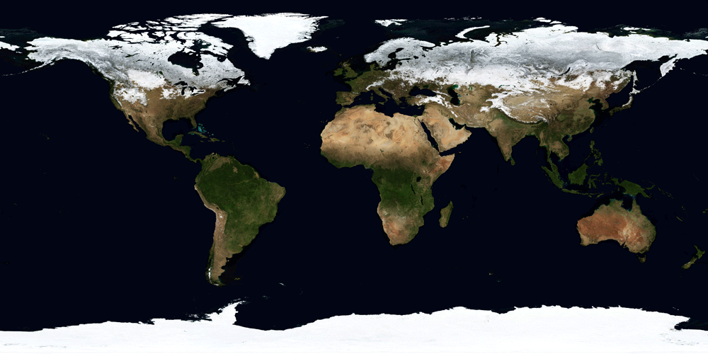
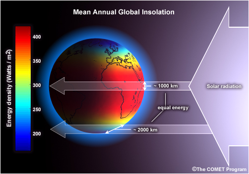
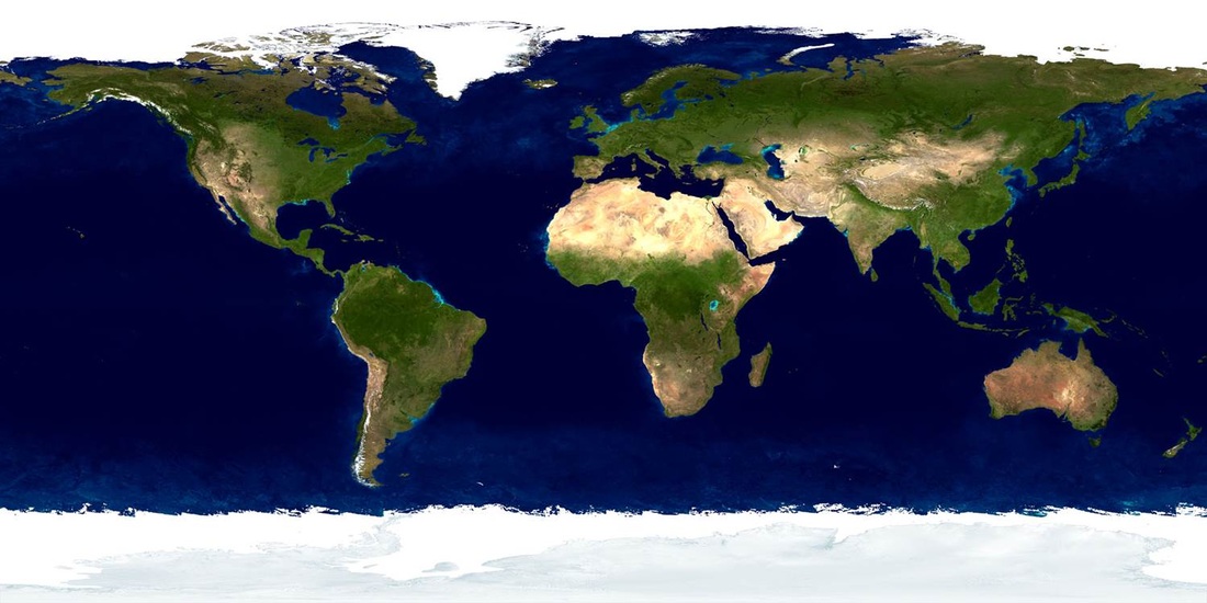
Because the Earth is a sphere, solar radiation from the Sun does not strike the surface evenly. This results in the Earth having too much heat in the tropical areas and not enough in the polar areas. The Ocean and Atmosphere move heat around the planet's surface. This system has the biggest influence on the patterns of life on the Earth. Image Source: |
|
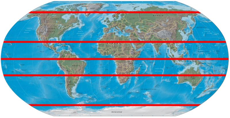
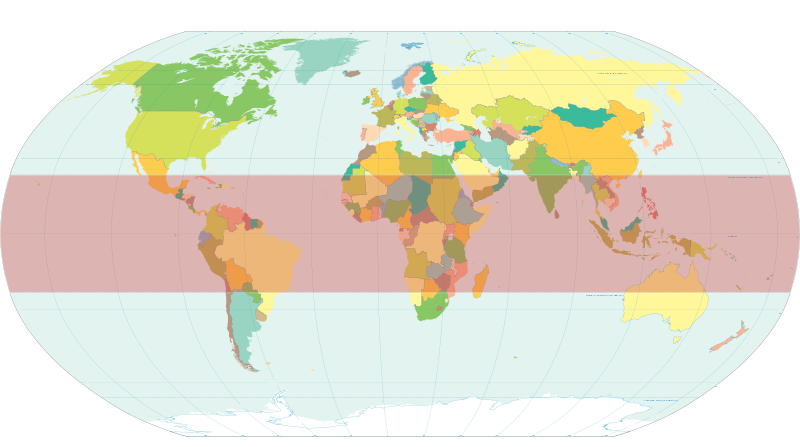
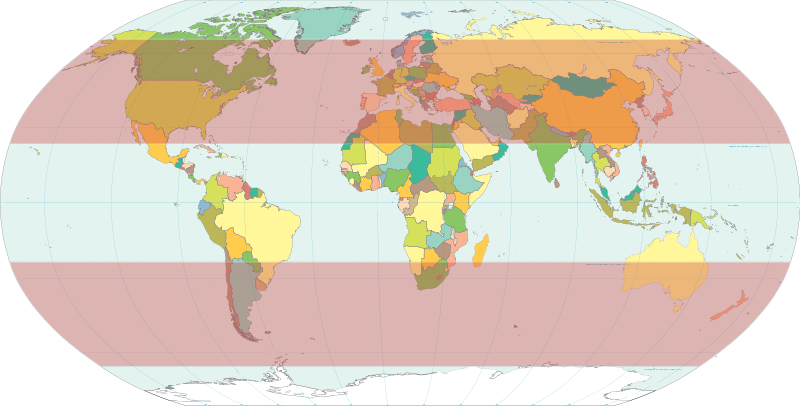
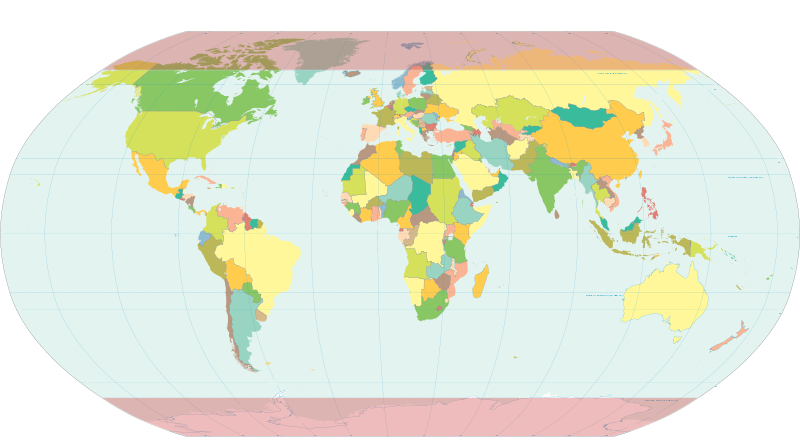
Major Lines of Latitude
|
|
The lines in red indicate the following:
Using these major lines of latitude. What patterns do you notice when looking at the satellite projection?
- The Arctic Circle (66.5˚ N)-- the northernmost region to have complete daylight or nighttime during the solstices.
- The Tropics of Cancer (23.5˚ N)-- the northernmost region to receive direct solar radiation overhead.
- The Equator (0˚)-- divides the Earth into the northern and southern hemispheres.
- The Tropics of Capricorn (23.5˚ S)-- the southernmost region to receive direct solar radiation overhead.
- The Antarctic Circle (66.5˚ S)-- the southernmost region to have complete daylight or nighttime during the solstices.
Using these major lines of latitude. What patterns do you notice when looking at the satellite projection?
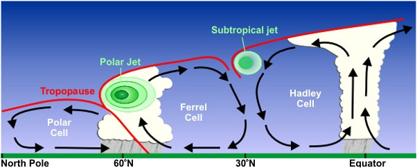
Climate Cells
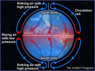
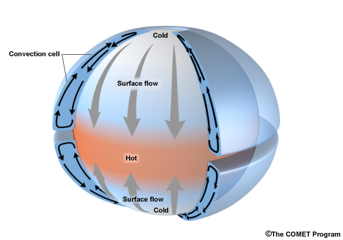
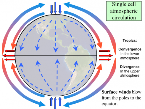
If the planet did not rotate, the heat would simply move in a single rotational pattern, known as a circulation cell.
|
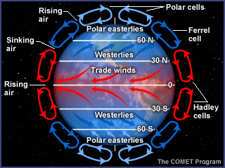
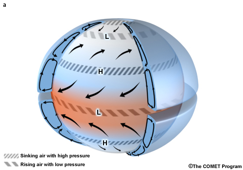
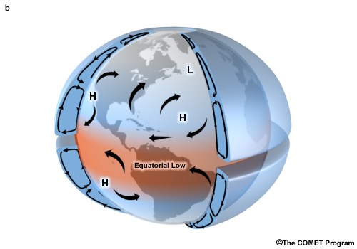
However, since our planet is moving, the rotation causes a three cell system to form: Hadley Cells over the tropics, Ferrel Cells over the temperate, and Polar Cells over the poles.
|
The atmospheric circulation cells. [Image Source: NASA]
|
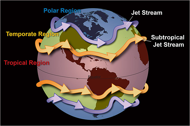
The Earth rotates underneath a envelope of air (the atmosphere). Jet Streams 'flow' in the opposite directions of the planet's spin. [Image Source: NOAA]
|
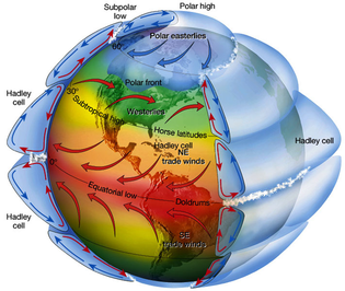
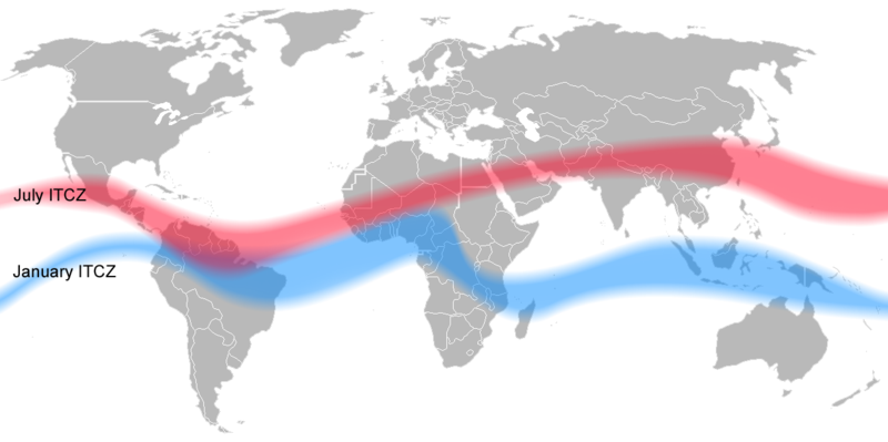
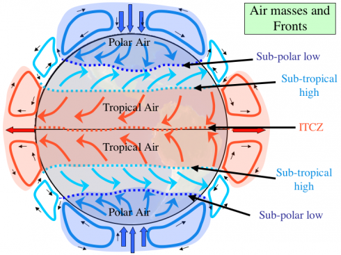
The ITCZ is an intense uplift of warm, moist air in the tropics. As it rises, the air cools and releases moisture. This results in tropical rain forests in South America, Africa, and Indonesia. Then this cooler, drier airs falls back to Earth, resulting in desert regions both 30˚ North and South of the Equator.
|
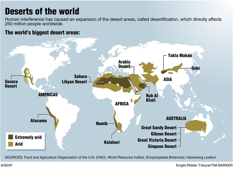
The location of the Hadley Cell (and the ITCZ) has a significant impact on the location of the world's deserts.
|
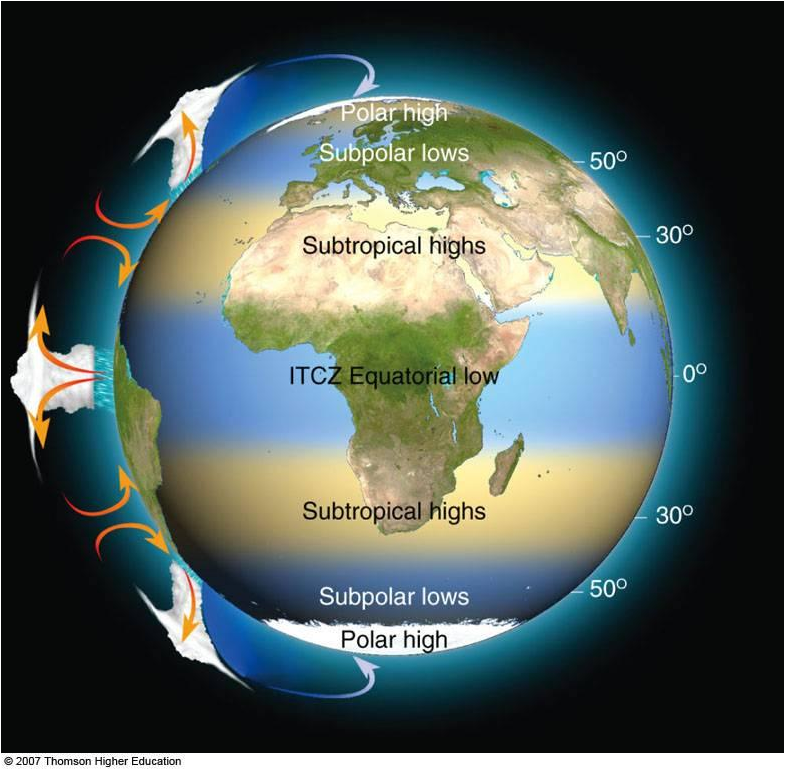
Semi-permanent pressure systems and Hadley cells. [Image Source: NASA]
|
Tropical Rain Forests: Equatorial Low
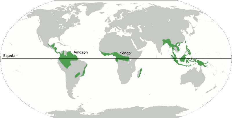
Image Source: Montessori Muddle
|
Sub-tropical Deserts: Subtropical Highs
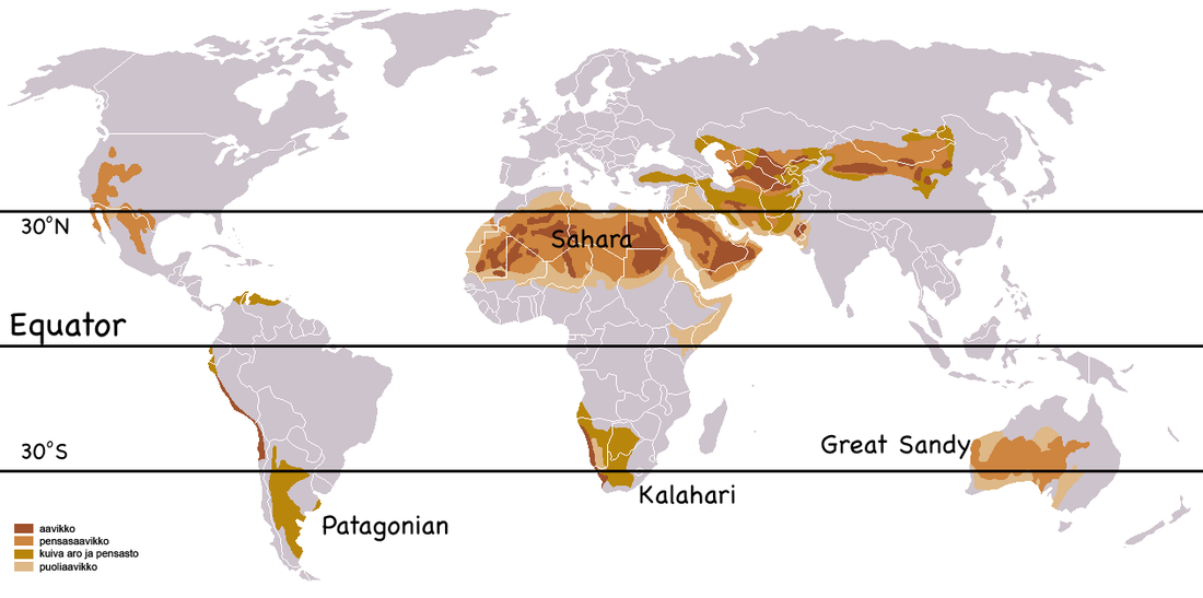
Image Source: Montessori Muddle
|
Taiga: Subpolar Lows
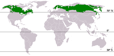
Image Source: Wikipedia
|
Use the images above to explain the differences in conditions as 30˚ and 60˚
Macrogeography: Big Geography Map Exercises
The Earth acts as single system that is influenced by circulation of solar radiation through the ocean and atmosphere. The global positions of land and water have a significant impact on how our planet functions. The following video shows some of these dynamic processes in action.
Atmospheric Circulation Models
Map Exercise: Global Climate Patterns
Download and open the following PDF file. Attach all the sections together to form a large map. [Suggestions: trim some edges with straight, well-cut lines to make the sides go together. Also, if you use tape, place it on the back of the sheets. This is important when coloring the map later.]
| world_map_no_borders.pdf |
Required Elements
|
Latitude Lines-- draw and label
Climatic Belts-- lightly outline the following areas
|
Gradient Coloring
Color the map based on a temperature or radiation gradient showing change between the tropics and the poles. The Inter-Tropical Convergence Zone (ITCZ)
Ocean Circulation
|
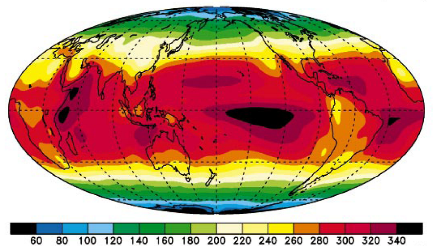
The Inter-Tropical Convergence Zone (ITCZ): The Earth's Climatic Equator
|
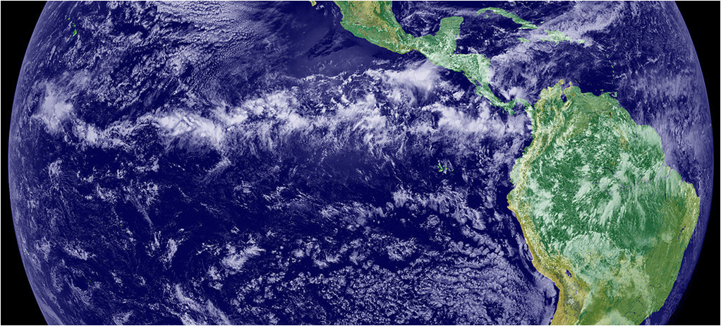
The ITCZ is the portion of the Earth's surface that receives the greatest amount of solar radiation at any give time throughout the year. Therefore, it changes during the year.
The ITCZ is the most important driving force in the global climate patterns. Image Sources: Wikipedia and NASA |
The Earth's Heat Distribution System: The Ocean-Atmosphere System
|
The Tropical Regions: This area receives high levels of direct solar radiation year round. It primarily has two seasons: wet and dry, and it never feels the effects of winter. Because it receives the greatest amount of heat, it is the drive force behind the Ocean-Atmosphere Heat Redistribution System. It is located between 23. 5˚ N and 23.5˚ S with the Equator (0˚) in between.
This area receives too much solar radiation. |
|
The Temperate Regions: The solar radiation fluctuates greatly between the summer and winter months. Therefore, temperate regions tend to have four distinct seasons: summer, spring, winter, and autumn. The majority of human populations live within this region. In the Northern Hemisphere, the temperate zone is located between 23. 5˚ N and 66.5˚ N, and in the Southern Hemisphere, it is located between 23. 5˚ S and 66.5˚ S.
This area swings between too much and not enough solar radiation. |
|
The Polar Regions: This area receives only indirect rays of solar radiation. It primarily has two seasons: dark and light, and it never feels the effects of summer. In the Northern Hemisphere, the polar zone is located between 66.5˚ N and 90˚ N, and in the Southern Hemisphere, it is located between 66.5˚ S and 90˚ S.
This area receives too little solar radiation. |
Gradient
Figure 2: World climate map demonstrating that comparable climate zones are present at higher latitudes in Western Europe compared with those in North America. Image Source: Nature/ Data taken from the WorldClim Database (http://www.worldclim.org/).

Ocean Ciculation
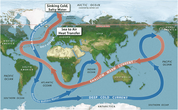
The Ocean Conveyor Belt
Ocean circulation is driven by density differences. (Density is controlled by ocean temperature and saltiness.) Cold, dense water in the Arctic merges with salty water from the Gulf Stream to create the sinking North Atlantic Deep Water (NADW) in the Norwegian-Greenland Sea. The NADW helps to drive global ocean circulation. Illustration The M Factory © Smithsonian Institution. [Image Source: Smithsonian]
Ocean circulation is driven by density differences. (Density is controlled by ocean temperature and saltiness.) Cold, dense water in the Arctic merges with salty water from the Gulf Stream to create the sinking North Atlantic Deep Water (NADW) in the Norwegian-Greenland Sea. The NADW helps to drive global ocean circulation. Illustration The M Factory © Smithsonian Institution. [Image Source: Smithsonian]
Map Exercise II: Surface Winds and Currents
Required Elements
Blank World Map
Blank World Map
- The Summer High Pressure Zones (the high pressure zones over water during the summers for each-- Northern Hemisphere in July and Southern Hemisphere in January)
- Ocean Surface Currents (The Gyres are the circular motion). Use colors to represent the warm and cool currents.
- Prevailing Wind Patterns. Use color to indicated if the winds are following towards the equator or towards the poles.
Atmospheric Cells on a planetary surface that is covered by water and it does not rotate.
|
Atmospheric Cells on a planetary surface that is covered by water and it does rotate.
|
Atmospheric Cells on a planetary surface that has both land and water and it does rotate.
|
Image Sources: Comet Program
|
Because the planet is rotating beneath the layer of gas (the atmosphere), the winds are deflected at an angle. This is known as the Coriolis Effect.
|
Image Source: Montessori Muddle
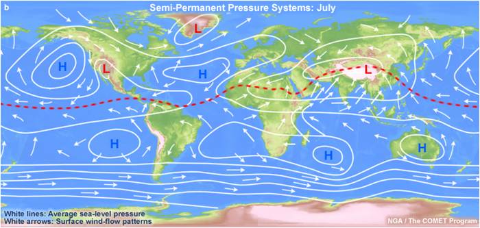
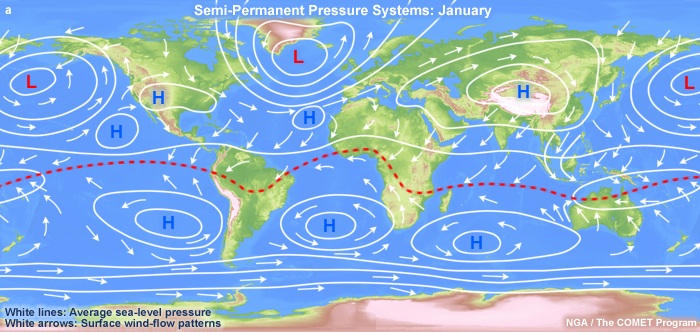
Image Source:
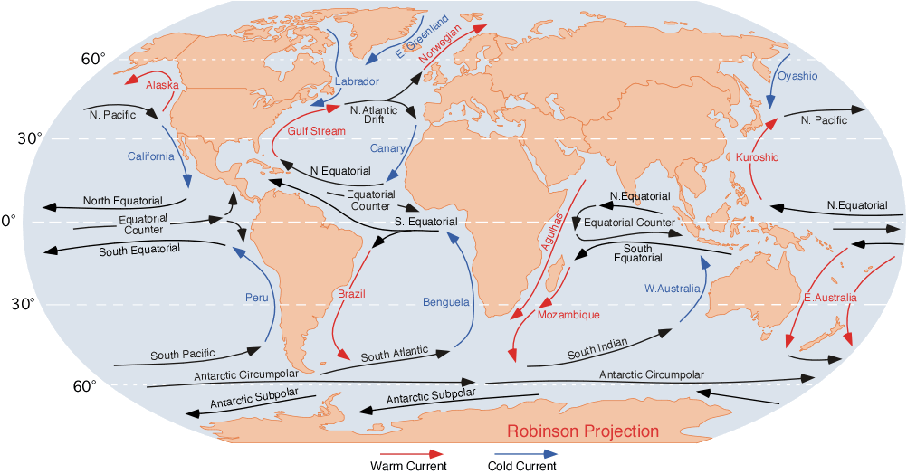
Image Source: Wikipedia, Ocean Currents
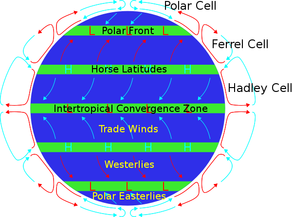
Image Source: Wikipedia, Atmospheric Circulation.
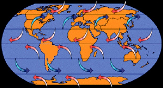
Image Source: NOAA (Posted on Smithsonian Site)
|
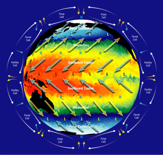
Image Source: DOE SciDAC
|
Global Climate Change Project
The Assignment: create a DK-style page layouts (minimum of 4 pages), or a children’s book (as many pages as needed) showing the at least 5 major areas of the global climate patterns.
Use pictures with captions and paragraphs written in your own words to explain how heat moves around our planet (i.e. from the Sun, around the cells, through the atmosphere and ocean surface currents, to the deep oceans).
You need to include at least 10 terms that we have discussed. There are others, but here are some to get you started. They must be underlined and explained in your text.
|
• Equinox
• Solstice • Aphelion • Perihelion • Hadley Cell • Ferrel Cell • Polar Cell
|
• Walker Circulation
• Thermohaline Circulation • Climashphere • Troposphere • Photic Zone • Equilibrium |
Assessment: You will be graded on the following: Project Rubric
· Content: how well did you explain the processes of heat moving around the planet?
· Organization: did you present it in a way that was easy to follow?
· Creativity: did you explain it in a fun, and imaginative way?
· Content: how well did you explain the processes of heat moving around the planet?
· Organization: did you present it in a way that was easy to follow?
· Creativity: did you explain it in a fun, and imaginative way?
